

Benbrack [Binn Bhreac]
Good walks are even better shared.
Overview
Exploring Benbrack [Binn Bhreac]
Introduction
Located in the picturesque Southern Uplands of Scotland, Benbrack stands proudly at 577 meters, offering adventurers a satisfying challenge amidst stunning landscapes. Known locally as Binn Bhreac, its name means 'spotted peak', which is rather fitting considering the fantastic views around!
Geology
Benbrack is formed from a mix of sedimentary rocks, primarily sandstones and shales. Over time, erosion has sculpted the mountain, leading to interesting geological features. The rocky outcrops provide a glimpse into the earth's history, making it a delightful spot for geology enthusiasts.
Routes
The most popular route is the Benbrack Circular Walk, a 12-kilometre trek that can be completed in around four hours. It's a moderately challenging route that starts in the nearby St John's Town of Dalry and offers a mix of delightful open fields and scenic forest. As you ascend, keep an eye out for the picturesque wildlife that calls this area home.
Summit Features
Reaching the summit, hikers are greeted by a unique stone cairn and a trig point, perfect for that brag-worthy photo. The views from the top are nothing short of breathtaking, making every step worthwhile.
Terrain Type
Be prepared for various terrains, from grassy slopes that invite a leisurely stroll to rocky sections that spark a bit of excitement. It’s a proper Scottish landscape, with a few boggy patches thrown in for good measure—because what’s a hike without a little mud?
Views
On a clear day, the summit rewards climbers with remarkable sights, including the distant Merrick and the rolling hills of Galloway Forest Park. For the best vistas, consider hiking in late spring or early autumn, when the scenery is at its most spectacular.
Hazards
While Benbrack isn’t mountainous mayhem, always be cautious of loose rocks and quick weather changes. Prepare for the notorious unpredictability of Scottish weather!
Access
Nearest parking is at St John's Town of Dalry, making it very convenient for those arriving by car. Public transport options are available but may not be frequent, so plan accordingly. The charm of the town itself, with local pubs and cafes, makes it a perfect base for your adventure.
Facilities
After your hike, take a well-earned rest in one of the local cafes or pubs in St John's Town of Dalry, where you can find food and restrooms to regroup and exchange tales of your ascent.
History
The Gaelic roots of Benbrack are etched in its name, hinting at a rich cultural heritage. Historically, this area was a vital route for livestock, deeply connected to the agricultural practices of the past.
In conclusion, Benbrack offers a delightful escape into nature, ideal for hikers wanting to immerse themselves in the beauty of the Southern Uplands. Whether you’re after stunning scenery, a spot of history, or just some fresh air, Benbrack is well worth the trek!
Happy hiking!
Explore routes near Benbrack [Binn Bhreac]
Public walks starting within 80 km of this hill. Nearby does not mean a route reaches the summit; check its map and access before setting out.
No public routes are currently listed within 80 km of Benbrack [Binn Bhreac] on Walkmates. This does not mean there are no paths here. Explore the map and check local access information before planning a walk.
Route planning notes
These notes describe possible approaches, not verified navigable routes or permission to cross land. Check current paths, local access rules and conditions before setting out.
Benbrack Circular Walk
A pleasant loop that starts from the nearby village and meanders through lovely pastoral landscapes before ascending the mountain.
Make a day of it, together
Find someone to share the walk with, or organise a day out along a route you like.
Photo Gallery
View all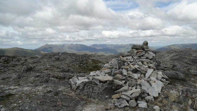 Photo could not load
L7655 : Summit cairn on Benbrack - View NE
Colin Park
Hill facts and local notes
Classifications
Elevation
584m
1,916 ft
Prominence
265m
Coordinates
53.5378, -9.8635
L765558
OS Map
37
At the Summit
At the summit, you'll find a distinctive stone cairn offering panoramic views in all directions, alongside a modest trig point that might just make your selfie epic.
Terrain & Geology
Benbrack is primarily composed of sedimentary rocks, including sandstones and shales, which give it a rugged characteristic. The erosion of these rocks has created significant features on the mountain's surface.
Views & Scenery
From the summit, you can see the rolling hills of the Southern Uplands and the distant peaks of the Galloway Forest Park, including the elusive Merrick.
History & Heritage
Name Origin
The name 'Binn Bhreac' translates to 'spotted peak' in Gaelic, likely referring to the visibility of the mountain from various landscapes.
Historical Significance
Historically, the area has been a significant route for livestock and has links to ancient agricultural practices.
Getting There & Facilities
Check current local access restrictions, parking rules and transport timetables before travelling. These notes do not confirm public access to the summit.
Parking
Parking can be found at the village of St John's Town of Dalry, with a small car park that accommodates around a dozen vehicles.
Public Transport
The area is accessible by bus from nearby towns, but services may be infrequent, so check the schedule beforehand.
Nearby Facilities
The nearest facilities, including a pub and several cafes, are located in St John's Town of Dalry, offering meals and restrooms.
Safety Information
Known Hazards
- Watch out for loose rocks on steeper sections and beware of sudden weather changes typical of the area.
General Safety Tips
- Check weather conditions before setting out
- Carry appropriate clothing and equipment
- Let someone know your planned route
- Take a map, compass, and GPS device
- Carry emergency supplies: food, water, first aid kit, torch
Hills
Some common questions about the hills answered
Are there group walks up Benbrack [Binn Bhreac]?
Many walkers use Walkmates to join or organise walks with others. You can check for group walks around Benbrack [Binn Bhreac] through the maps
Are there other walkers around Benbrack [Binn Bhreac]?
Activity varies by location and time, but Walkmates lets you see whether others have shared walks or shown interest in this area. Find other people through the walking friends search walking friends for Benbrack [Binn Bhreac] search or of course create your own walk for Benbrack [Binn Bhreac]
Can I organise a walk to Benbrack [Binn Bhreac]?
Yes. If there aren’t any walks listed already, you can create a walk and make it available for others to join.
If you're signed up to Walkmates, you can create a walk to Benbrack [Binn Bhreac].
How do I find a walk up this hill?
There are often multiple ways to walk this hill, depending on experience and route preference. Walkmates helps you explore walks and routes that others have shared.
Can I suggest a new route up Benbrack [Binn Bhreac]?
Yes. You can suggest or create routes to share with others. Walkmates focuses on the social side of walking, so routes are used to help people organise walks and explore areas together, rather than as detailed navigation tools or route libraries.
Other uses really appreciate knowledgeable walkers sharing their routes. Share your favourite route to Benbrack [Binn Bhreac] here
The is an error or something incorrect about this hill. How do I let you know?
We always strive to keep the information on Walkmates as accurate as possible. If you find an error, please let us know through the contact form and we'll aim to correct it as quickly as possible
Community Discussion
Comments
Location
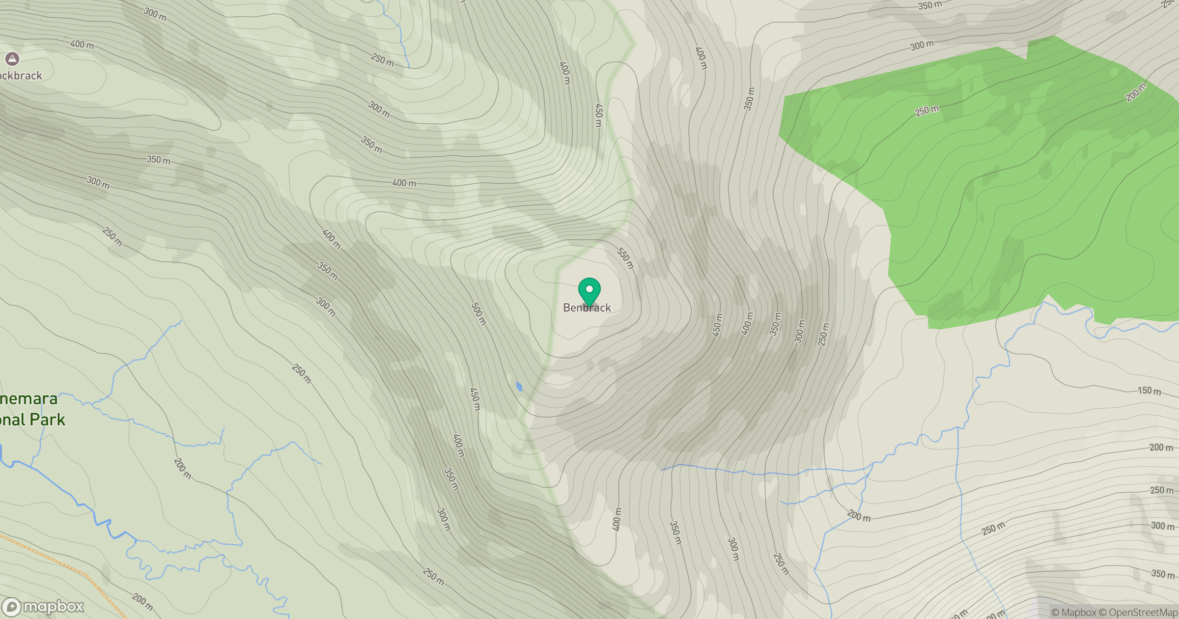
Grid reference: L765558
View on OpenStreetMapOpens a map in a new tab, centred on the hill.
Hills within 30 km
Straight-line distance, not a walking route or confirmation of access.
Mweelrea
814m
Croagh Patrick
764m
Mucanacht [Meacanacht] [Muckanaght]
655m
An Chailleach [Bencullagh]
634m
Benbaun
729m
No comments yet. Be the first.